Citymapper is your new maps app for getting from place to place, providing you aren’t driving.
It’s available for Google Play and iOS, and it’s the multimodal transit app.
Multimodal = multiple modes…and boy does this include it.
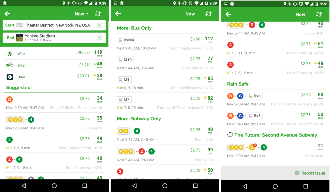
It’ll get you from Point A –> Point B with a variety of options. In NYC for example you have Buses, Subways, Trains, City Bikes, Ferries, Ubers and Car2Go’s.
When you start your route, it’ll give you up to the minute times, for all the subways/buses, including delays and reroutes that may be happening.
It’ll also tell you how long it would take to walk/bike the route, and what it will cost to Uber the route right now.
Here is an example from this morning, from Times Square to Yankee Stadium:

They give you the best suggested methods based on time, they give you suggestions based on only one mode of transit, and they give you options with the least outdoor exposure (Rain Safe), along with a futuristic plan for when the 2nd Avenue Subway kicks off.
Enjoy, and safe travels!

2 thoughts on “Citymapper – App Review”